Vordingborg Municipality (Vordingborg Kommune)
The municipality takes its name from the town of the same name.
The Masnedsund Bridge connects the town of Vordingborg to the island of Masnedø. The Storstrøm Bridge connects Masnedø to the neighboring municipality of Guldborgsund on Falster near the town of Orehoved. The bridge is 3,199 meters long and supports two lanes of traffic and a single-track railway. It was inaugurated in 1937.
The Farø Bridges (The Farø High Bridge and the Farø Low Bridge) opened in 1985 and connect the two municipalities from the town of Bakkebølle Strand over Farø island (part of former Møn municipality) to Falster near the town of Sortsøgab. Bogø island is also part of the municipality.
As part of wider municipal reforms, an earlier Vordingborg municipality was merged with its neighboring municipalities of Langebæk, Møn, and Præstø on 1 January 2007, forming the enlarged Vordingborg Municipality.
Around 135 km (84 mi) east of Vordingborg municipality across the Baltic Sea is Bornholm, the easternmost municipality of Denmark, which is a part of the Capital Region of Denmark.
For the location of Vordingborg municipality relative to its neighbors, see the location diagram at the bottom of the corresponding article on Danish language Wikipedia, Vordingborg Kommune.
Map - Vordingborg Municipality (Vordingborg Kommune)
Map


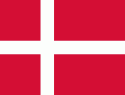
Country - Denmark
 |
 |
| Flag of Denmark | |
As of 2013, the Kingdom of Denmark, including the Faroe Islands and Greenland, has a total of 1,419 islands above 100 m2; 443 of which have been named and of which 78 are inhabited. Spanning a total area of 42943 km2, metropolitan Denmark consists of the northern part of the Jutland peninsula and an archipelago of 406 islands. Of these, the most populated island is Zealand, on which the capital Copenhagen is situated, followed by Funen, the North Jutlandic Island, and Amager. Denmark's geography is characterised by flat, arable land, sandy coasts, low elevation, and a temperate climate. As of 2022, it had a population of 5.928 million (1 October 2022), of which 800,000 live in the capital and largest city, Copenhagen. Denmark exercises hegemonic influence in the Danish Realm, devolving powers to handle internal affairs. Home rule was established in the Faroe Islands in 1948 and in Greenland in 1979; the latter obtained further autonomy in 2009.
Currency / Language
| ISO | Currency | Symbol | Significant figures |
|---|---|---|---|
| DKK | Danish krone | kr | 2 |
| ISO | Language |
|---|---|
| DA | Danish language |
| EN | English language |
| FO | Faroese language |
| DE | German language |
